| |
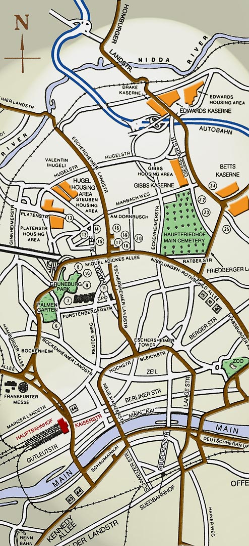
Below is a center section of the Army's last known map of
Greater Frankfurt before the closing of nearly all U.S. military
facilities in the area in the mid 1990's. Most of the street
names and landmarks were still relevant to the 1965-68 period.
Drake Kaserne is on the north and Kennedy Allee is on the south,
leading to the Flughafen, or airport. At the bottom of this page
is a reference guide to the numbered points on the map and to
other special spots. Be sure to print out a copy of this map
for your next trip back to Frankfurt!
Our appreciation to Mara Hahlbrock of Berlin, Germany,
for adding coloring and lighting effects to the original, drab,
black & white map. Mara is the sister of PIO staffer Paul
Leopold.
|